Rodavia
PREPARATION AND MAINTENANCE OF ROAD INVENTORIES
Previous
Next
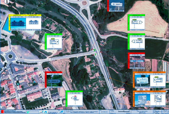
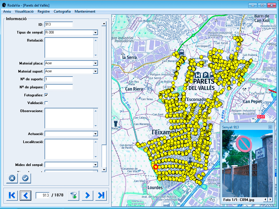
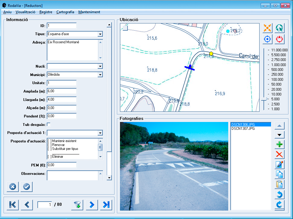
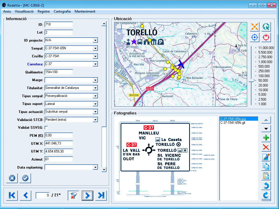
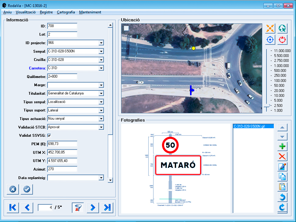
RODAVIA is a Geographic Information System (GIS) that aims to facilitate the signalisation of infrastructures to the administration.
The system has been promoted by the Department of Territorial Policy and Public Works and is implemented, among others, in the General Directorate of Tourism for the management and territorial and thematic signage of Catalonia.
Operation
Previous
Next
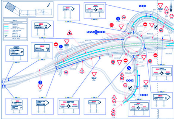
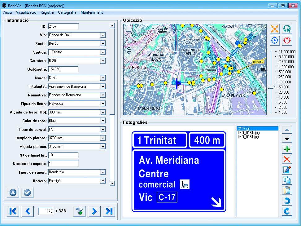
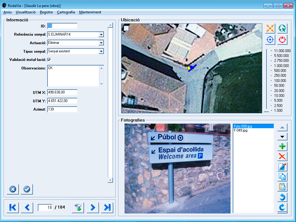
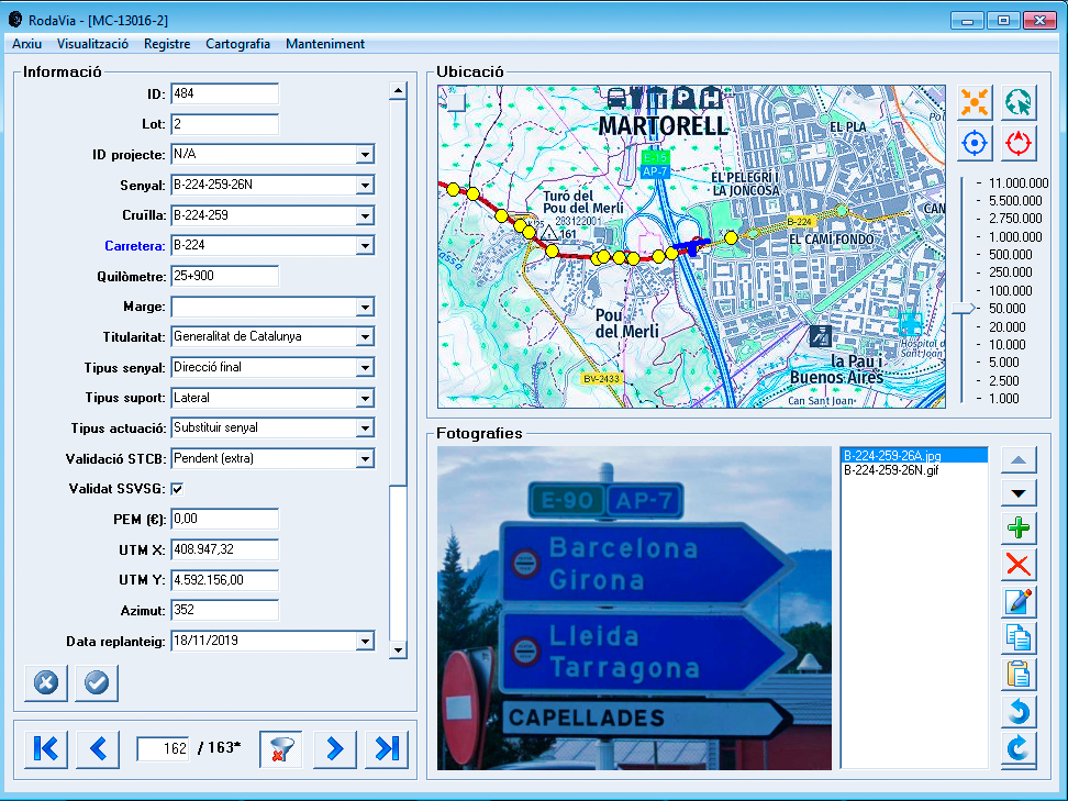
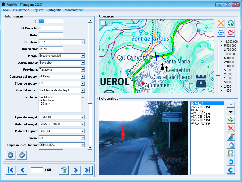
RODAVIA facilitates the development, maintenance and operation of signals or any other point element.
- Data entry and updating from PC.
- Capture GPS coordinates in photos.
- Rethinking with UTM coordinates and azimuts.
- Visualisation of data and WMS on digital cartography.
- Definition of the database open to the user.
- Functions of filtering, generation of lists and printing of signal sheets.
Specifications
The minimum equipment for its operation is
- Intel or AMD 1 GHz speed processor
- 256 MB of RAM.
- Screen with a color deth of 32 bits.
- The program needs Excel for generating the budget.